Charting the Unknown by Kim Petersen
Author:Kim Petersen
Language: eng
Format: epub
Publisher: Behler Publications, LLC
26
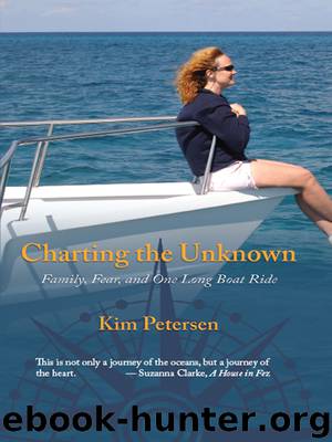
From Miami it is 42 nautical miles, through the Gulf Steam, to the island of Bimini in the Bahamas. The Gulf Stream is a warm flowing ocean current which is birthed in the Gulf of Mexico, exits through the Strait of Florida and then continues northward up the eastern seaboard of America and Newfoundland, Canada, before heading east across the Atlantic where it becomes known as the North Atlantic Drift. It is between 50 and 100 miles wide and between 2,600 and 4,000 feet deep. The current can flow fast at its hump, or midpoint, up to just shy of five knots, but it tapers off to zero at its outskirts.
In good weather, the Gulf Stream poses little problem for boaters. You must factor the current into the crossing, but a good GPS and charting program will keep you right on course. Winds from the north can pose a problem, as they can stack the waves of the northerly flowing Gulf Stream and significantly increase wave height. From the marina in Miami, we kept a close eye on the wind forecast for several days before deciding to raise the hook and attempt our first maiden offshore voyage.
In midday sunshine, we cast off from the marina and emerged from Government Cut into calm waters. About an hour later, we began to skirt the Stream. The water changed from green-blue to a vibrant purple-blue. This being the maiden offshore voyage, there was a lot to do. We checked the fuel lines, filters, temperature of the engines, steering, GPS, and compass. All systems were working well, and Chrysalis was handling better than expected. Since it was calm, Mike decided to bump up our speed from 10 knots to 18 knots in order to test the engines. The engines roared and the bows rose up out of the water before falling slightly, as if she had planing hulls. This was curious to us because Chrysalis has twin, full displacement hulls, and should not rise out of the water. We traveled this way for awhile going at 18 knots, about 22 miles an hour. Just about the time I was thinking, “What's the big deal traveling offshore?” our starboard engine sputtered several times, then failed. With a concerned look, Mike left to check on it. Before he could make an assessment, the port engine quit as well.
I sat at the helm and nervously considered the possibilities should both engines fail to restart. We might drift in the Gulf Stream all the way up to Cape Fear, named, I suspected, for a reason. A more probable scenario would find us calling Tow Boat US. They could come and tow us back to Miami. It was fortunate for us that the coordinates between Miami and Bimini were well traveled. Help might not be minutes away, but likely a few hours at most. Not so if we were in the middle of the Atlantic, say, between Bermuda and the Azores. Even with a satellite phone, assistance of any kind would be several days away, possibly more.
Download
This site does not store any files on its server. We only index and link to content provided by other sites. Please contact the content providers to delete copyright contents if any and email us, we'll remove relevant links or contents immediately.
| Crime & Criminals | LGBT |
| Special Needs | Women |
We're Going to Need More Wine by Gabrielle Union(19046)
Pimp by Iceberg Slim(14507)
Bombshells: Glamour Girls of a Lifetime by Sullivan Steve(14075)
The Radium Girls by Kate Moore(12028)
Becoming by Michelle Obama(10026)
Educated by Tara Westover(8054)
The Girl Without a Voice by Casey Watson(7889)
Wiseguy by Nicholas Pileggi(5786)
Hitman by Howie Carr(5095)
The Wind in My Hair by Masih Alinejad(5095)
The Rules Do Not Apply by Ariel Levy(4969)
Hunger by Roxane Gay(4928)
On the Front Line with the Women Who Fight Back by Stacey Dooley(4873)
Year of Yes by Shonda Rhimes(4757)
The Borden Murders by Sarah Miller(4325)
Papillon (English) by Henri Charrière(4274)
Joan of Arc by Mary Gordon(4110)
American Kingpin by Nick Bilton(3886)
Patti Smith by Just Kids(3777)
