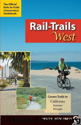
Rail-Trails West by Rails-to-Trails-Conservancy
Author:Rails-to-Trails-Conservancy
Language: eng
Format: epub
ISBN: eBook ISBN: 9780899977096
Publisher: Wilderness Press
Published: 2009-06-15T16:00:00+00:00
Contact: California State Parks
Soquel Drive
Aptos, CA 95003
(831) 763-7062
www.parks.ca.gov/?page_id=666
CALIFORNIA
Los Gatos Creek Trail
Location
Santa Clara County
Endpoints
Forbes Mill Museum to Lexington Reservoir
Mileage
1.8
Roughness Index
3
Surface
Dirt, gravel
The Los Gatos Creek Trail serves as a siren’s call on weekends when all manner of trail users are out enjoying the pathway.
It is difficult to travel through suburban Los Gatos for more than a few minutes without noticing an abundance of cyclists and runners in the area. If you are strolling downtown, chances are that the biker whizzing by you is headed for the Los Gatos Creek Trail. During the week this rail-trail sees a moderate amount of traffic, but on weekends it bustles with activity. From 20-somethings clutching their morning lattes to energetic cyclists and families walking their dogs, you’ll see everyone out enjoying this path on Saturdays and Sundays.
In its entirety, the Los Gatos Creek Trail spans 9.7 miles and passes through several cities, but this description focuses on the Los Gatos portion that is a rail-trail. It follows a former South Pacific Coast Railroad line that transported passengers from Santa Cruz to Alameda in the late 1800s. Begin at the northern end next to the landmark Forbes Mill Museum, an 1854 flour mill and annex that exhibits Los Gatos area memorabilia. You will find a water fountain there—the only one on the trail—but no restrooms.
Los Gatos Creek is on your left as you step onto the unpaved trail. Wrapped in riparian undergrowth, the sparkling creek is lovely. A not-so-bucolic feature, Highway 17, is on your right, but the creek effectively masks the sound of the nearby traffic. The trail has a moderate incline as it flows northward, and includes one short but steep climb at 1.3 miles. The surface is a bit rocky here, and only experienced cyclists will be able to ascend it without dismounting.
After this incline the trail levels off and continues flat toward a paved footbridge. This is technically the end of the trail, and most runners turn back here. If you wish to continue, cross this bridge and head up a steep, paved switchback, which brings you to Alma Bridge Road. Just across Alma Bridge Road is Lexington Reservoir County Park, a lovely daytime destination. Its main attraction is the 914-acre human-made Lexington Reservoir for which the park is named. The park offers nonmotorized boating, fishing, hiking trails and ample areas to picnic.
DIRECTIONS
To reach the northern trailhead, from Highway 17, exit at East Los Gatos Avenue and turn right on Los Gatos-Saratoga Road. Continue on this road until it becomes East Main Street. Turn right on Church Street, which will take you straight into the Forbes Mill parking lot. The signed trailhead is located next to the Forbes Mill Museum.
Download
This site does not store any files on its server. We only index and link to content provided by other sites. Please contact the content providers to delete copyright contents if any and email us, we'll remove relevant links or contents immediately.
Good by S. Walden(3560)
A Short History of Nearly Everything by Bryson Bill(2698)
Claridge's: The Cookbook by Nail Martyn & Erickson Meredith(2407)
Hidden Valley Road by Robert Kolker(2297)
On Trails by Robert Moor(1902)
The Art of Flight by unknow(1878)
Rick Steves London 2018 by Rick Steves & Gene Openshaw(1870)
Deep South by Paul Theroux(1837)
KITCHEN CONFIDENTIAL Adventures in the Culinary Underbelly by Anthony Bourdain(1801)
Blue Highways by William Least Heat-Moon(1777)
Trans-Siberian Railway by Lonely Planet(1758)
1,000 Places to See in the United States and Canada Before You Die (1,000 Places to See in the United States & Canada Before You) by Patricia Schultz(1653)
Long Bright River by Liz Moore(1591)
Ticket to Ride by Tom Chesshyre(1590)
Flight by Elephant(1531)
The Great Railway Bazaar: By Train Through Asia by Paul Theroux(1505)
BBQ Joints by David Gelin(1469)
The Old Patagonian Express: By Train Through the Americas by Paul Theroux(1400)
Practice Makes Perfect by Gilda Nissenberg(1390)
