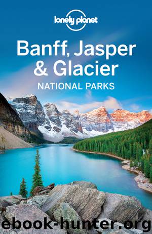
Lonely Planet Banff, Jasper & Glacier by Lonely Planet

Author:Lonely Planet
Language: eng
Format: epub
Publisher: Lonely Planet
Published: 2016-04-21T04:00:00+00:00
q Saturday Night Lake Loop
Duration Three to four hours
Distance 27.4km (17 miles)
Difficulty Moderate-difficult
Start/Finish Jasper
Nearest Town Jasper
Summary An interesting technical ride through a root-ridden and sometimes swampy forest, with plenty of nature-watching opportunities and half-a-dozen quiet, unspoiled lakes.
If Jasper lacks one thing, it is long-distance loop trails, which makes this roller-coaster jaunt all the more satisfying. Even better, it begins and ends in the townsite, yet never feels particularly close to civilization. Sometimes erroneously called the 20-mile Loop (it’s nearer 17 miles), the trail is numbered 3, gains 540m (1771ft) in elevation and never rises above the timberline. There are some tough technical stretches in the middle part of the ride involving mud, roots and short, steep descents.
From the center of Jasper follow Patricia St southwest to Patricia Cres. Turn right at the T-junction and the trailhead is on your left. Proceeding counterclockwise around the loop means you save the best descents till last, so take the right-hand No 3 option and follow the switchbacks out of town up onto the Pyramid Bench. A little over 1km (0.6 miles) of climbing brings you to the end of the dirt Cabin Lake Rd at the eastern end of Cabin Lake. From here take the singletrack along the lake’s northeast shore and begin a gradual wooded ascent to smaller Saturday Night Lake, 4.3km (2.7 miles) distant (a 400m/437yd spur trail leads off the main trail to the lake and its campground). The going gets tougher for the next 9km to 10km (5 to 6 miles) with muddy, swampy sections along the base of the Victoria Cross Range, interspersed with some narrow creek crossings and plenty of tree roots. The trail begins to loop back east at the 11.5km (7.2-mile) mark at a log bridge at the bottom of a waterfall. Just beyond here is High Lakes and the second campground (the trail is also a popular two- to three-day hike). You’ll be descending now over roots and rocks past Minnow Lake, where things settle down to a smoother pace to Caledonia Lake, a peaceful pond amid the trees. Fork left at the trail junction just past the lake and continue for 4km (2.4 miles; passing Marjorie Lake) back to the start point in Jasper Town.
Download
This site does not store any files on its server. We only index and link to content provided by other sites. Please contact the content providers to delete copyright contents if any and email us, we'll remove relevant links or contents immediately.
Canadians by Roy MacGregor(1459)
Chris Chelios by Chris Chelios(1413)
109 Walks in British Columbia's Lower Mainland by Mary Macaree(1290)
I Hear She's a Real Bitch by Jen Agg(1208)
From the Tundra to the Trenches by Eddy Weetaltuk(1180)
Stone by Stone by Liz Bryan(1176)
Berlin Travel Guide by Lonely Planet(1174)
Germany Travel Guide by Lonely Planet(1152)
Liquor, Lust and the Law by Aaron Chapman(1151)
Moon Atlantic Canada by Andrew Hempstead(1111)
105 Hikes in and Around Southwestern British Columbia by Stephen Hui(1080)
Wine by Rod Phillips(1063)
The Prince by unknow(1062)
Uncle John's Bathroom Reader Plunges into Canada by Bathroom Readers' Institute(1045)
1,000 Places to See in the United States & Canada Before You Die by Patricia Schultz(1044)
50 Best Girlfriends Getaways in North America by Marybeth Bond(1039)
How to Move to Canada by Terese Loeb Kreuzer Carol Bennett(1026)
DK Eyewitness Top 10 Travel Guides Montreal & Quebec City by DK(1013)
Hidden Ontario by Terry Boyle(997)
