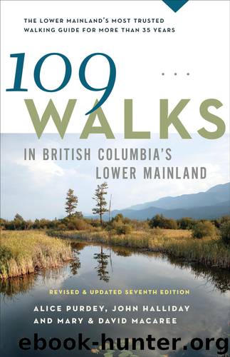
109 Walks in British Columbia's Lower Mainland by Mary Macaree

Author:Mary Macaree
Language: eng
Format: epub
ISBN: 978-1-77100-001-7
Publisher: Greystone Books
Published: 2014-04-25T16:00:00+00:00
57 Richmond · Delta · South Surrey
WATERSHED PARK TO MUD BAY
Return: 14 km (8.7 mi) Allow: 4 hours
Surface: packed, paved, trail
Rating: easy
Season: all year
ACCESS
Transit: Route #340 to Kittson Parkway at McKenzie Drive (in Delta), then walk 400 m west to the trailhead
Vehicle: Make your way to 64 Avenue in North Delta or Surrey. It is the northern boundary of Watershed Park and provides access to Kittson Parkway, which you follow to the westernmost Watershed Park sign, 800 m east of Highway 91, or 1.8 km (1.1 mi) west of Scott Road. Park off the road on the south side.
Car GPS entry: 11200 Kittson Parkway, Delta
Trailhead: 49° 7.126’ N, 122° 54.949’ W
IF YOU LIKE both forest and shoreline, then this walk is for you. Beginning in Watershed Park, you travel through second-growth coniferous forest, through swampland with its largely unseen creature activities, past overgrown pastureland and along a road between railway tracks and blueberry fields before you arrive at Mud Bay with its abundant birdlife.
There are several park entrances off Kittson Parkway; this walk begins at the westernmost one, where a short, narrow trail descends to encounter the obvious Lower Trail onto which you turn left. This you follow past various small trail and road diversions used by mountain bikers, runners and dog walkers. After 2 km (1.2 mi), you pass under Highway 10, then continue between neglected pastureland and steep slopes until, at a high chainlink fence, you are directed south. Here, a raised path, the Delta–South Surrey Regional Greenway, bounded by scrubby trees, leads through swampland; the views and bird watching are best when the trees are leafless. Your arrival at Colebrook Road (go left) marks the beginning of a 2 km (1.2 mi) roadside trek past agricultural land until you cross the railway tracks and pass under Highway 99 to arrive at Mud Bay (parking). As you cross the tracks, note that the rails from the U.S. join the Canadian line here.
An extension of Boundary Bay, Mud Bay is a delta formed by the Serpentine and Nicomekl Rivers. The tidal marshes and eelgrass beds support millions of migratory birds that stop or overwinter here, making it a birder’s paradise. A looped dyke trail, with many benches, looks across the bay to Blackie Spit close in and to Point Roberts and Tsawwassen in the distant right.
Well rested, you must retrace your steps to Watershed Park, but there you can vary your return. Six hundred metres beyond the Highway 10 underpass, turn right up a wide, stony road. Very quickly, you arrive at the Meadow, a gently sloping grassland with benches and a viewpoint overlooking Mud Bay, where you just were. From the north side of the Meadow, follow woodsy Gravity Bowl Trail for a few paces, then go left onto Canyon Trail. This contours the hillside until it exits onto Water Tower Road near a water tank, and 150 m up the hill, where an artesian well once supplied cool refreshment on hot days. From here, follow the Pinewood Trail for the final 900 m back to the start.
Download
This site does not store any files on its server. We only index and link to content provided by other sites. Please contact the content providers to delete copyright contents if any and email us, we'll remove relevant links or contents immediately.
| Alberta | British Columbia |
| Manitoba | New Brunswick |
| Newfoundland | Nova Scotia |
| Ontario | Prince Edward Island |
| Quebec | Saskatchewan |
| Territories |
Canadians by Roy MacGregor(1150)
Chris Chelios by Chris Chelios(1048)
109 Walks in British Columbia's Lower Mainland by Mary Macaree(1007)
Stone by Stone by Liz Bryan(957)
Berlin Travel Guide by Lonely Planet(914)
I Hear She's a Real Bitch by Jen Agg(901)
Germany Travel Guide by Lonely Planet(891)
Liquor, Lust and the Law by Aaron Chapman(884)
From the Tundra to the Trenches by Eddy Weetaltuk(876)
Moon Atlantic Canada by Andrew Hempstead(837)
105 Hikes in and Around Southwestern British Columbia by Stephen Hui(833)
The Prince by unknow(831)
1,000 Places to See in the United States & Canada Before You Die by Patricia Schultz(825)
Uncle John's Bathroom Reader Plunges into Canada by Bathroom Readers' Institute(823)
Wine by Rod Phillips(814)
DK Eyewitness Top 10 Travel Guides Montreal & Quebec City by DK(796)
How to Move to Canada by Terese Loeb Kreuzer Carol Bennett(783)
Hidden Ontario by Terry Boyle(776)
50 Best Girlfriends Getaways in North America by Marybeth Bond(774)
