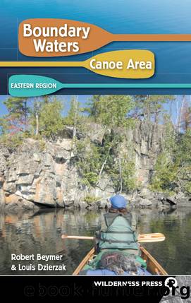
Boundary Waters Canoe Area by Robert Beymer
Author:Robert Beymer
Language: eng
Format: epub
ISBN: eBook ISBN: 9780899976112
Publisher: Wilderness Press
Published: 2009-01-15T00:00:00+00:00
For those who seek canoe-country variety, derive satisfaction from hard work, and prefer to travel where few others dare to go, this rugged loop has got it all. Much of this interesting route will be through parts of the BWCAW that receive very light useâeven during the busiest summer periods. Only in the vicinities of Long Island, Sawbill, Cherokee and Brule lakes are you likely to encounter other people.
Although youâll average âonlyâ seven portages per day, each day includes at least one long and exhausting carry. If you need two trips to get your gear across the 49 portages, youâll be walking over 39 miles during this week in the wildernessâan average of over 5.5 miles per day. In my book, thatâs a rugged canoe trip. If youâre not ready for such a challenge, either spread this route over eight or nine days or consider a different route.
Wildlife watchers will be delighted with the opportunities. Moose, in particular, are plentiful in much of this region. Anglers with energy to spare should also be delighted with the opportunities along this route. Most types of BWCAW game fish can be found at some point in the loop, including northern pike, walleyes, smallmouth bass, and even brook trout.
Day 1 (7 miles): Poplar Lake, p. 320 rods, Skipper Lake, p. 21 rods, Little Rush Lake, p. 50 rods, Rush Lake, p. 10 rods, Banadad Lake. (See comments for Day 1, Route #49-1.)
Day 2 (9 miles): Banadad Lake, p. 95 rods, Sebeka Lake, p. 180 rods, Ross Lake, p. 195 rods, Cave Lake, p. 109 rods, Long Island Lake, Long Island River, p. 5 rods, river, p. 28 rods, Gordon Lake, p. 140 rods, Unload Lake, creek, Frost Lake. The four portages between Banadad and Long Island lakes are mostly downhill. But three of them have rough paths and the fourth (180 rods) has a path with some sloping rocks that are quite slippery when wet. Youâll pass through some wet and muddy marshy areas on the 95-rod and 195-rod trails. Windfalls could also block any of the trails, since this region does not see many visitors and trail maintenance is not a priority by USFS portage crews.
There is a good chance that youâll see more people on Long Island Lake than on all of the other lakes so far. Enjoy the respite from long and frequent portages during the 3.5-mile stretch across Long Island and Gordon lakes and the Long Island River.
The 140-rod trail leading west from Gordon Lake climbs over a fairly steep hill, but then levels off on a good, smooth path to Unload Lake. The shallow creek joining Unload and Frost lakes may be blocked by a beaver dam that requires a lift-over. Or you can bypass the creek on a 40-rod portage to Frost Lake. It is a rough path that is not often used. But it may be necessary during late summer or an unusually dry year, when the connecting creek is too shallow for a loaded canoe.
There are
Download
This site does not store any files on its server. We only index and link to content provided by other sites. Please contact the content providers to delete copyright contents if any and email us, we'll remove relevant links or contents immediately.
Canadians by Roy MacGregor(1502)
Chris Chelios by Chris Chelios(1451)
109 Walks in British Columbia's Lower Mainland by Mary Macaree(1326)
I Hear She's a Real Bitch by Jen Agg(1246)
Stone by Stone by Liz Bryan(1221)
From the Tundra to the Trenches by Eddy Weetaltuk(1220)
Berlin Travel Guide by Lonely Planet(1200)
Liquor, Lust and the Law by Aaron Chapman(1184)
Germany Travel Guide by Lonely Planet(1183)
Moon Atlantic Canada by Andrew Hempstead(1138)
105 Hikes in and Around Southwestern British Columbia by Stephen Hui(1117)
The Prince by unknow(1095)
Wine by Rod Phillips(1094)
Uncle John's Bathroom Reader Plunges into Canada by Bathroom Readers' Institute(1086)
1,000 Places to See in the United States & Canada Before You Die by Patricia Schultz(1086)
50 Best Girlfriends Getaways in North America by Marybeth Bond(1075)
How to Move to Canada by Terese Loeb Kreuzer Carol Bennett(1054)
DK Eyewitness Top 10 Travel Guides Montreal & Quebec City by DK(1047)
Hidden Ontario by Terry Boyle(1027)
