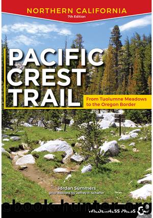
Pacific Crest Trail: Northern California by Jordan Summers & Jeffrey P. Schaffer

Author:Jordan Summers & Jeffrey P. Schaffer
Language: eng
Format: epub
Publisher: Wilderness Press
Published: 2020-11-15T00:00:00+00:00
Continuing, the PCT first crosses a minor saddle, then follows a descending ridge north, offering views south toward Granite Chief, southwest toward Needle and Lyon Peaks, northwest down the North Fork American River canyon, and north across the canyon toward your next main goal, Tinker Knob. The views actually improve as you get lower, and then you leave the crest and switchback down to a junction with Painted Rock Trail (15E06) (1,143.4â7,552').
Along the last part of this stretch, you may see signs of an old trail that once went to Mountain Meadow Lake. This lake lies on private land and is part of an ecological study area that is closed to the public. As such, please donât plan to camp near the lake.
From the junction, the PCT descends a few yards to cross the North Forkâs headwaters, then climbs around and over granitic outcrops. The trail enters a large bowl, with spacious camping on a waterless flat below the trail (1,144.5â7,945').
In 0.5 mile, switchback for a sustained 0.6-mile climb to Tinker Knob saddle and the junction with Cold Stream Trail (1,145.7â8,639'). Sharp-crested Peak 8,781, just south of you, divides the impressive panorama you have to the south and east. For a few minutes head northwest on the PCT, to where it starts to drop along the Sierra Crest (1,145.9â8,745').
For a 360-degree panorama of the Lake Tahoe Basin/Donner Pass area, leave the trail and climb carefully southwest to the highly fractured summit of Tinker Knob, reached in 5â10 minutes.
Inspecting the terrain seen from todayâs summit, you view a volcanic landscape that has undergone severe erosion, partly due to glaciers, and this erosion has exposed the underlying granitic and metamorphic bedrock. Among the more prominent landmarks is Mount Rose (10,778'), which stands high above Lake Tahoeâs north shore. To the south stands aptly named Granite Chief, devoid of volcanic rock, and in the distant south shines the snowy, granitic Crystal Range, which forms the backbone of Desolation Wilderness.
On the PCT, head northwest along the open, windswept crest, with drought-resistant wildflowers.
As you drop west around Anderson Peak, note how its massive lava flow dips southeast, indicating its source was a volcano in the northwest.
Just north of Anderson Peak, the PCT momentarily returns to the crest at a saddle. From there, a trail (1,147.6â8,256') climbs steeply south up the Sierra Crest to Benson Hut, which is available as an emergency shelter (no water), on the north ridge of Anderson Peak. The PCT then rounds Peak 8,374 to a shallower saddle, from which you have excellent views of the Truckee basin, to the east.
Backward glances toward Anderson Peak mark your progress northwest, and after a while you have your first views of Donner Lake, seen as you approach a broad saddle just south of a weather station (1,150.5â7,991') below Mount Lincoln. In this section, most of the land west of the crest is private property. You enter U.S. Forest Service land where the PCT leaves the crest for an arc north across steep, eroded slopes of Mount Lincoln.
Download
This site does not store any files on its server. We only index and link to content provided by other sites. Please contact the content providers to delete copyright contents if any and email us, we'll remove relevant links or contents immediately.
Fading Ads of New York City by Frank Jump(674)
Indians on Vacation by Thomas King(610)
Bill Bailey's Remarkable Guide to British Birds by Bailey Bill(608)
Lonely Planet's Ultimate Travel by Lonely Planet(579)
The Outdoor Knots Book by Clyde Soles(568)
The World's Greatest Mountain Ranges - Geography Mountains Books for Kids | Children's Geography Book by Baby Professor(548)
South From Granada by Gerald Brenan(500)
Best Climbs Los Angeles by Damon Corso(494)
Hiking Oklahoma by Jamie Fleck(488)
New England Skiing by E. John B. Allen(487)
Fodor’s Bahamas by Fodor’s Travel Guides(457)
Sport by Grand Scott(456)
Baseball in Tampa Bay by A.M. de Quesada(411)
100 Great Wildlife Experiences by Fair James D.;(400)
A Coney Island Reader by Louis J. Parascandola(399)
Desolation Wilderness and the South Lake Tahoe Basin by Jeffrey P. Schaffer(396)
Hikertrash: Life on the Pacific Crest Trail by Erin Miller(390)
Fodor’s Oregon by Fodor’s Travel Guides(389)
Hamish's Mountain Walk by Hamish Brown(370)
