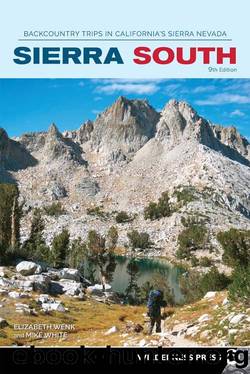
Sierra South by Elizabeth Wenk Mike White

Author:Elizabeth Wenk, Mike White
Language: eng
Format: epub
Publisher: Wilderness Press
Published: 2021-05-14T16:00:00+00:00
DAY 2 (Thousand Island Lake to Agnew Meadows Trailhead, 10.5 miles): From your campsite, return to the JMT and turn right (southeast), walk past lakeshore meadows, and cross the bridge over the Thousand Island Lake outlet. Following the JMT south, pass first Emerald Lake (9,885') and its neighboring tarn and then the more strikingly sapphire and picturesque Ruby Lake (9,917'), rimmed to the west by impressive walls; both offer camping. Switchbacking briefly to a shallow saddle, you soon see Garnet Lake below. Rivaling Thousand Island Lake, Garnet Lake is also islet dotted but sits in a slightly more enclosed basin at the base of Banner Peak. Garnet Lake consequently offers fewer campsites, and since there is also a 0.25-mile no-camping zone radiating from its outlet, it is best to follow a use trail along its northern shore in search of legal campsites; depart west at 9,938'; 37.71529°N, 119.15660°W. After this spur junction, the trail winds down between polished slabs to the shore, still walking on the Ritter Rangeâs beautiful dark-colored metavolcanic rock. The trail then traces Garnet Lakeâs east shore, crossing its outlet on a rickety bridge and passing the near-invisible junction with the lateral from the River Trail, before climbing some 400 feet to a saddle with a seasonal tarn; when there is water about, there are nearby campsites.
Ahead is an 1,100-foot descent, first past a small meadow and through a tiny canyon with mixed lodgepole pine and mountain hemlock cover. At a distinct right-trending bend in the trail, an unmarked and unmaintained trail leads left to Laura Lake (small campsites). Trending southwest, the JMT, your route, drops down a dry, dusty slope of pinemat manzanita and then turns back south into a shaded draw with campsites as long as the adjacent Shadow Creek tributary has water.
As you approach Shadow Creek, you reach a junction where right (northwest) leads to Ediza Lake (Trip 37), while you turn left (east, then northeast), following the JMT down Shadow Creek toward Shadow Lake. Nearby is a flat with another cluster of campsites, your last for many miles, for there is no camping between the creek and the trail along the heavily used Shadow Creek corridor and also no camping at Shadow Lake. Following Shadow Creekâs canyon downstream to Shadow Lake, the trail winds through lodgepole forest and across open, slabby knobs of metavolcanic rock beside the fast-flowing stream. A short distance upstream of Shadow Lake, indeed before you see the lake, is a junction where the JMT turns right (south), crossing the creek on a bridge, while your route continues left (northeast) around the lakeâs forested northern shore. Near Shadow Lakeâs outlet, take a break on the shoreline to enjoy the view across the lake to Mount Ritter.
Download
This site does not store any files on its server. We only index and link to content provided by other sites. Please contact the content providers to delete copyright contents if any and email us, we'll remove relevant links or contents immediately.
Fading Ads of New York City by Frank Jump(674)
Indians on Vacation by Thomas King(610)
Bill Bailey's Remarkable Guide to British Birds by Bailey Bill(608)
Lonely Planet's Ultimate Travel by Lonely Planet(579)
The Outdoor Knots Book by Clyde Soles(568)
The World's Greatest Mountain Ranges - Geography Mountains Books for Kids | Children's Geography Book by Baby Professor(548)
South From Granada by Gerald Brenan(500)
Best Climbs Los Angeles by Damon Corso(494)
Hiking Oklahoma by Jamie Fleck(488)
New England Skiing by E. John B. Allen(487)
Fodor’s Bahamas by Fodor’s Travel Guides(456)
Sport by Grand Scott(456)
Baseball in Tampa Bay by A.M. de Quesada(411)
100 Great Wildlife Experiences by Fair James D.;(400)
A Coney Island Reader by Louis J. Parascandola(399)
Hikertrash: Life on the Pacific Crest Trail by Erin Miller(390)
Fodor’s Oregon by Fodor’s Travel Guides(388)
Desolation Wilderness and the South Lake Tahoe Basin by Jeffrey P. Schaffer(384)
Hamish's Mountain Walk by Hamish Brown(370)
