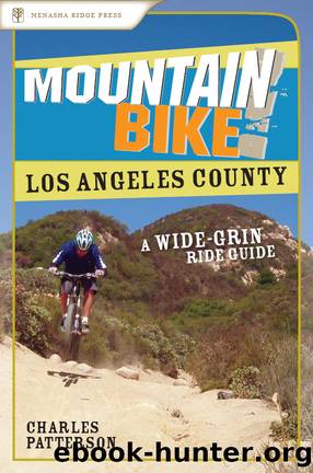
Los Angeles County by Charles Patterson

Author:Charles Patterson
Language: eng
Format: epub
ISBN: eBook ISBN: 9780897327817
Publisher: Menasha Ridge Press
Published: 2007-11-15T00:00:00+00:00
GPS TRAILHEAD COORDINATES (WGS84)
UTM Zone 11S
Easting 340440
Northing 3780850
Latitude N 34.09â²23â³
Longitude W 118.43â²51â³
DIRECTIONS
From Los Angeles and the San Fernando Valley, take US 101 north and exit at Cheseboro. Briefly head north on Palo Comado Canyon Drive; then make a right onto Cheseboro Road. After 0.75 miles, turn right into the first parking lot, beyond which is a driveway that leads to a second, larger parking area with bathroom facilities.
In Brief
The Cheeseboro Ridge/Sulfur Springs Loop is the perfect after-work excursion because it mixes just the right amount of technical descending, aerobic climbing, and desert and chaparral scenery into a nice, compact package. For this reason, this route is a staple of the North Valley XC scene and even entices regular visitors from other areas. Of all the rides in SoCal, Cheeseboro Ridge has the potential to be the hottest so riding this route in the late afternoon or early morning is a far better option than attacking it midday.
Download
This site does not store any files on its server. We only index and link to content provided by other sites. Please contact the content providers to delete copyright contents if any and email us, we'll remove relevant links or contents immediately.
Fading Ads of New York City by Frank Jump(663)
Indians on Vacation by Thomas King(607)
Bill Bailey's Remarkable Guide to British Birds by Bailey Bill(592)
Lonely Planet's Ultimate Travel by Lonely Planet(572)
The Outdoor Knots Book by Clyde Soles(551)
The World's Greatest Mountain Ranges - Geography Mountains Books for Kids | Children's Geography Book by Baby Professor(547)
South From Granada by Gerald Brenan(499)
Best Climbs Los Angeles by Damon Corso(490)
Hiking Oklahoma by Jamie Fleck(484)
New England Skiing by E. John B. Allen(483)
Fodor’s Bahamas by Fodor’s Travel Guides(455)
Sport by Grand Scott(449)
Baseball in Tampa Bay by A.M. de Quesada(405)
100 Great Wildlife Experiences by Fair James D.;(398)
A Coney Island Reader by Louis J. Parascandola(386)
Desolation Wilderness and the South Lake Tahoe Basin by Jeffrey P. Schaffer(382)
Hikertrash: Life on the Pacific Crest Trail by Erin Miller(380)
Fodor’s Oregon by Fodor’s Travel Guides(380)
Hamish's Mountain Walk by Hamish Brown(368)
